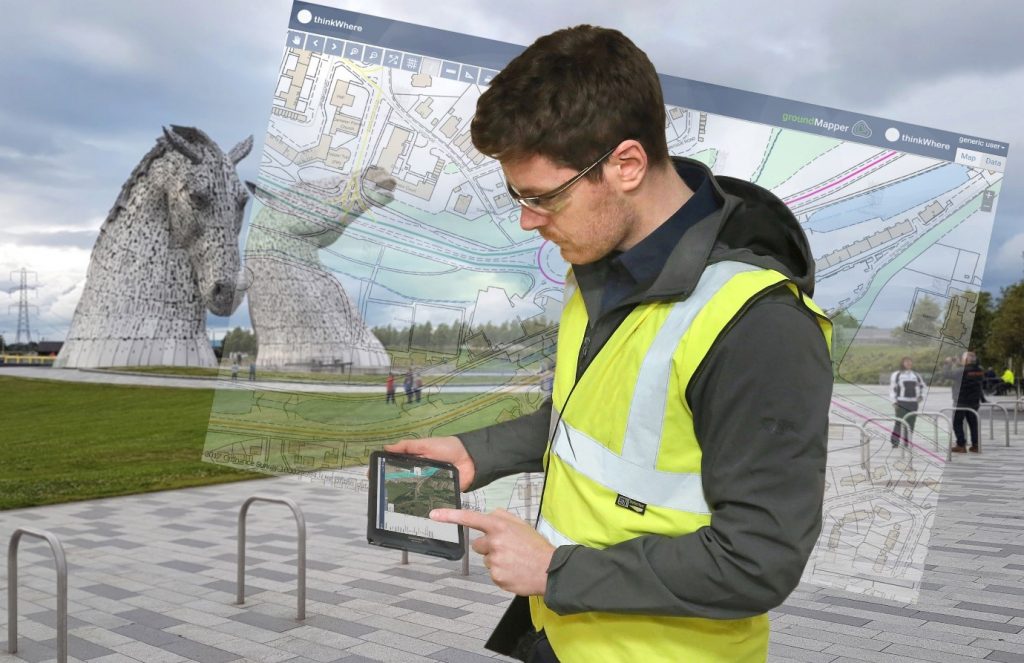
SCOTTISH technology company thinkWhere has released a new version of groundMapper, the web mapping software for managing and sharing project-based maps and data with on-the-ground project teams, clients and key stakeholders. The system allows easy access to Ordnance Survey maps and hundreds of free-to-use datasets from organisations such as Scottish Natural Heritage, the British Geological Survey.
The latest version of groundMapper includes the ability to add, update and manage custom geographic datasets, incorporates what3words geocoding and has the capacity to add non-spatial data and look-up tables.
“Since launching groundMapper to market in 2015, we have worked closely with both existing and prospective users to devise and deliver a product roadmap that meets a range of customer requirements,” commented Alan Moore, CEO of thinkWhere. “This version does just that. It provides access to hosted data combined with the ability to add project-specific maps and associated information such as photos, reports and documents. Making use of the latest innovations in Cloud and open source technologies, it’s straightforward to set up and is really easy to use across multiple projects and project stakeholders.”
Hosted by thinkWhere, groundMapper is specifically designed for the management of multiple projects across diverse geographical areas. It provides a simple, intuitive interface with online editing, collaboration and visualisation and with easy-to-use administrative controls. The system also now offers online data editing, advanced document management and additional data services.
In addition to accessing Ordnance Survey open and commercial data, hundreds of free-to-use datasets from organisations such as Scottish Natural Heritage, the British Geological Survey and Natural Resources Wales are also available. With what3words integrated, the geocoding system that uses a combination of three dictionary words to describe a location, groundMapper 2 offers a simpler way to navigate and locate assets or features and additional data services that improve accessibility of data in even the most remote of locations.
Current groundMapper customers include AWPR (Aberdeen Western Peripheral Route) Construction Joint Venture, Scotland’s leading provider of conveyancing searches Millar & Bryce and the infrastructure centre of expertise Scottish Futures Trust.